over a billion users worldwide, Google Maps is the digital cartographer of our daily lives. We tap it for the quickest route around a traffic snarl, search for the nearest coffee shop with a 4.5-star rating,
and dutifully follow the pulsing blue dot that represents our physical selves in the digital ether. This functionality reliable, ubiquitous, and profoundly useful—has become so ingrained that we rarely look beyond it. We’ve grown accustomed to seeing the world through Maps’ prescribed lenses: the default map view, the satellite imagery, the traffic overlays.
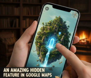 But nestled within this everyday application lies a feature of astonishing subtlety and power, one that quietly subverts the very premise of passive, dot-following navigation. It doesn’t shout its name from the main menu. It requires no complex setup. Yet, for those who discover it, it transforms Google Maps from a turn-by-turn guide into a dynamic, context-aware compass. This hidden gem is not a new layer or a flashy AR mode; it’s a fundamental shift in perspective called “Live View” in walking navigation, and its true magic is unlocked not on the street, but inside buildings and complex transit hubs.
Most of us have used, or at least seen, Live View for walking. You start pedestrian directions, tap the “Live View” button, and raise your phone. Your camera view activates, superimposing giant, floating arrows and street names onto the real world, showing you exactly which way to walk. It’s helpful, especially in unfamiliar cities, a high-tech solution to the age-old problem of “which way is north on this map?” But this street-level use is merely the appetizer.
The truly transformative, and often overlooked, application activates when your blue dot goes indoors—where GPS signals wither and die. Next time you’re disembarking a train at a labyrinthine underground station, or trying to find Gate B42 in a sprawling
international airport, or locating a specific store in a multi-level shopping mall, don’t resign yourself to squinting at static, often confusing, directory maps. Instead, pull up Google Maps, search for your destination within that building (e.g., “Gate B42” or “Platform 3”), and start walking directions. The moment Maps detects you’re in a supported location (and the list is vast and growing), a small, almost humble card will appear on the navigation screen: “Live View available here.”
Your camera feed becomes a real-time navigational canvas. Instead of a disembodied blue dot drifting erratically in a grey void (the typical fate of indoor mapping), you see the actual concourse, terminal, or mall hallway in front of you. Overlaid onto this reality
are clear, persistent markers. A giant, floating label points down a corridor to your gate. A digital path, anchored to the very floor you’re standing on, snakes its way around corners and up escalators. The orientation is instant and flawless. You are no longer interpreting a 2D abstract; you are being guided through the 3D world itself.
The technology enabling this is a quiet marvel. It uses a combination of visual positioning service (VPS) and Google’s vast database of “Street View” style imagery collected indoors (with permission, often via trekker backpacks). Your phone’s camera
scans the visual landscape—the unique pattern of storefronts, signage, architectural features, and even ceiling structures. It matches these visual cues against Google’s stored imagery to pinpoint your location and orientation with centimeter-level accuracy, all without a whiff of GPS. It’s wayfinding via visual fingerprinting.
The implications of this hidden feature are profound, especially when you consider the universal human experience of navigational anxiety in transit spaces.
For the Stressed Traveler: Airports and train stations are temples of stress, where time is scarce and confusion is plentiful. Missing a connection because you couldn’t find the right terminal or platform is a modern nightmare. Live View dismantles this
anxiety. You can step off a long-haul flight, jet-lagged and disoriented, and immediately chart a precise, confident course to baggage claim, customs, or your connecting gate. It eliminates the frantic scanning for small signs, the second-guessing at every fork, the need to ask for directions in a language you might not speak. It grants a sense of control and competence in inherently chaotic environments.
For the Practical Shopper: Large malls, department stores, and even big-box retailers can be frustrating to navigate. You know the store you want is “somewhere on the second level.” With Live View, you can search for the specific store, see the path materialize in front of you, and be led directly to its entrance, saving time and tedium. It turns a sprawling commercial maze into a manageable, linear journey.
For the Accessibility Revolution: This feature is a quiet game-changer for accessibility. For individuals with cognitive or visual impairments that make interpreting traditional maps difficult, a live, arrow-and-path-guided view of the real world is exponentially clearer. It provides a continuous, contextual thread to follow, reducing dependency and increasing independence in complex spaces.
For the Urban Explorer: It’s not just about transit and commerce. Many major museums, convention centers, and university campuses are also mapped. Finding a specific exhibit hall, a conference room, or a departmental office becomes an intuitive, point-and-walk experience.
Despite its brilliance, the feature remains somewhat “hidden” because it doesn’t force itself upon you. It sits patiently, available only when contextually relevant. There’s no grand “Indoor Live View” button on the home screen. You have to be in a supported location, with a pedestrian destination set, for the option to reveal itself. This subtlety is both its strength and the reason so many users are still unaware of it.
Of course, it has limitations. It requires a decent camera and some lighting. It works best in areas Google has visually mapped, which, while extensive, is not universal. And, like any AR feature, using it involves holding up your phone, which can feel slightly awkward in a crowd (though the guidance is so quick you often only need a brief scan to re-orient).
The broader lesson here, however, extends beyond the feature itself. The “hidden” Live View for indoor navigation represents a pivotal shift in the philosophy of digital maps. We are moving from the age of the map-as-chart to the age of the map-as-lens.
For decades, digital maps were about representation—creating an accurate, searchable, updatable abstraction of the world. The blue dot was our proxy in that abstraction. Live View, particularly in its indoor incarnation, flips this model. The abstraction recedes. The map becomes a transparent layer through which we see and interpret the physical world directly. The technology doesn’t want you to stare at the screen; it wants you to look through the screen at reality, which it then augments with just the right information, at just the right place, in just the right perspective.
It’s a move from navigation as a separate, screen-bound task to navigation as an integrated, environmental sense. It’s giving us a form of digital proprioception—an awareness of our location and path within a space, delivered not as a set of instructions to be decoded, but as an enhanced perception of the space itself.
So, the next time you find yourself in the echoing hall of a train station or the gleaming corridor of an airport, resist the urge to wander aimlessly or puzzle over static signs. Open Google Maps, find your destination, and look for that unassuming card. Tap “Live View,” lift your phone, and let the arrows fall into place on the world itself. You’ll be doing more than finding Gate B42. You’ll be glimpsing a future where our technology doesn’t just tell us about the world, but seamlessly illuminates our path through it, turning every complex space into a place we can navigate with innate confidence. That’s not just a hidden feature; it’s a hidden revolution, quietly active in the palm of your hand.